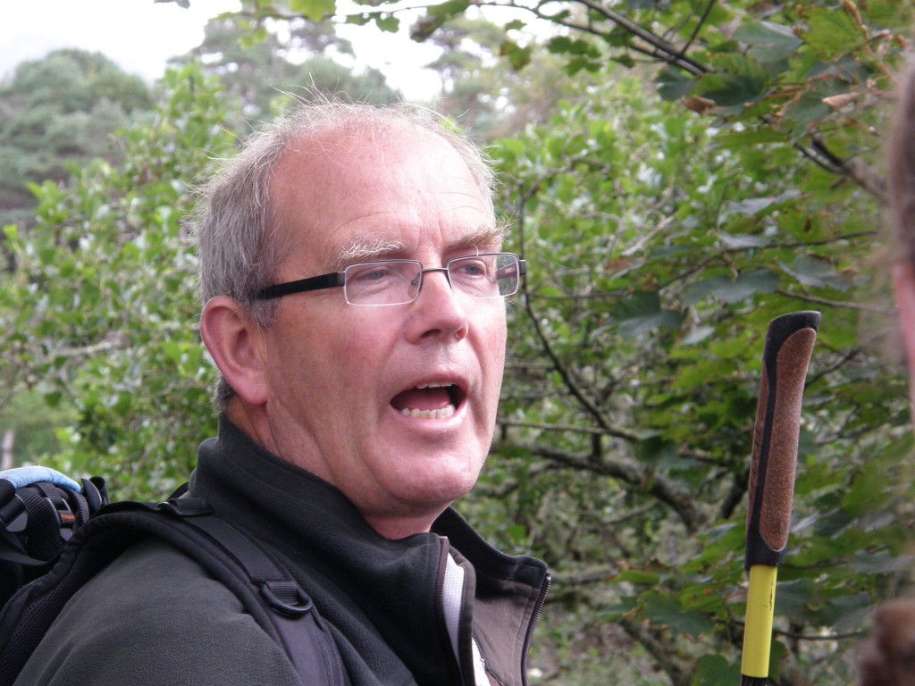
Yesterday and today our student body toured the demesne of Ballynahinch Castle, wandered the narrow main street of Roundstone, and climbed a steep, rocky, boggy hill outside of Cashel in the company of Michael Gibbons, a native of Connemara who is one of Ireland’s leading field archaeologists, a writer, broadcaster, and mountaineer. He is a former director of local and national archaeological survey programs. In his talks about holy wells, ancient burial sites, and the history of the Gaelic lords, it was quite evident that he is very knowledgeable about Irish history especially the pilgrimage tradition in Ireland. I later learned that he spent three years excavating the summit of Croagh Padraig, climbing more than 2,500 feet to work every morning. He certainly moved skillfully and quickly up the hillside in Cashel!
Michael has supervised archeological work in such diverse places as the Negev Desert, Egyptian Sinai, and Southern Greece. He has lectured throughout Ireland, at Oxford and Cambridge, at the American National Geographic Society, and at the Smithsonian Institution in Washington, D.C. It was quite a privilege to spend an afternoon hillwalking with him. (Half of the students when on his tour on Monday and half today. I was in the second group.)
Our first stop was at Ballynahinch Castle, a place where Evelyn and I spent a couple of days on our first trip to Ireland in 2005. I was disappointed that today we didn’t actually go into the hotel (yesterday’s group apparently did), but simply roamed the demesne following a circular path around the castle itself.
A famous resident of Ballynahinch was Richard Martin, also known as “Humanity Dick”, founder of The Royal Society for the Prevention of Cruelty to Animals (RSPCA). His ancestors took over the house in 1590. His father the present manor house in the early 1700’s as an inn, the same purpose it now serves as one of the finest hotels in Ireland.
The name Ballynahinch comes from the Irish Baile na hInse meaning “settlement of the island”, a reference to the small island fortress in the lake over which the castle looks. The estate comprises 450 acres of woodlands, gardens, lakes, and rivers, just a small portion of the more than 200,000 acres which the “The Ferocious O’Flahertys” ruled from this place. The lands of the O’Flaherty clan stretched to within fifteen miles of Galway City on the east and into County Mayo to the north-west. The clan leaders were the Gaelic Lords of Connaught and held castles at Ballynahinch, Aughanure, Doon, Moycullen, Bunowen, and Renvyle.
Perhaps the most famous O’Flaherty was Grace O’Malley from Mayo who married Donal O’Flaherty in 1546. Called the Pirate Queen of Connemara, she is well known for her meeting with Queen Elizabeth I in 1593. At the age of 63 years at the time, she was said to be an awesome and formidable lady. Although Irish was her native tongue, Grace conversed comfortably the English queen in Latin. An English court scribe described her this way: “In the wild grandeur of her mien erect and high before an English Queen she dauntless stood.”
On the grounds of the estate, Michael Gibbons showed us a holy well dedicated to St. Feithin (Festus), one of several which stretch in a fairly straight line from east to west across this part of Ireland. He explained the importance and history of holy wells in the folk religion of Irish people. What I found of interest is that holy wells were disliked by and the tradition actively discouraged by both Anglican evangelical missionaries and the French-trained Roman Catholic clergy who came to this area after English law again permitted Catholicism to be practiced; nonetheless, the tradition continued and even today one finds holy wells as places of reverence throughout this nation. The Roman church seems to have learned the lesson that this sort of folk religion cannot be obliterated and so has adopted many of these sites as places of pilgrimage. The holy well at Ballynahinch, however, is not one of them as it has dried up (according to legend it did so because it was insulted by a Protestant).
We also saw, from a distance, the island fortress or crannog from which the area gets its name and the remains of a 16th century cannon used by the O’Flaherty’s to defend their headquarters. (The term crannog refers to emplacements on small islands, often artificial ones; remains of them can be found in many of Ireland’s lakes. The name is derived from the old Irish crannóc from crann, tree. These islands in many cases were fortified and lived on by people as late as the 17th century.)
After hiking around Ballynahinch, we drove to Roundstone where we spent an hour having lunch. I’ve written about Roundstone in another post on this blog.
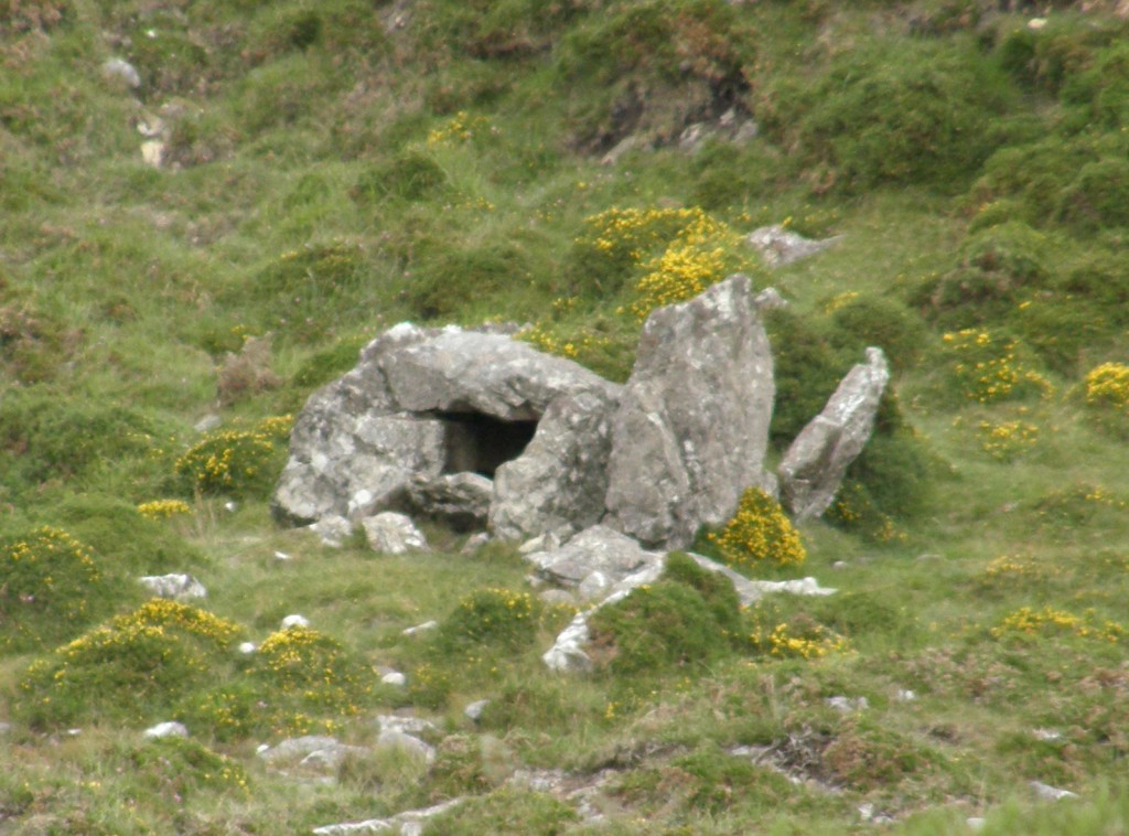
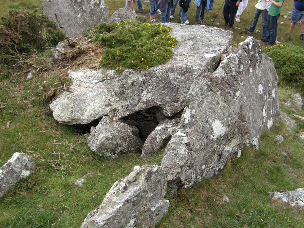
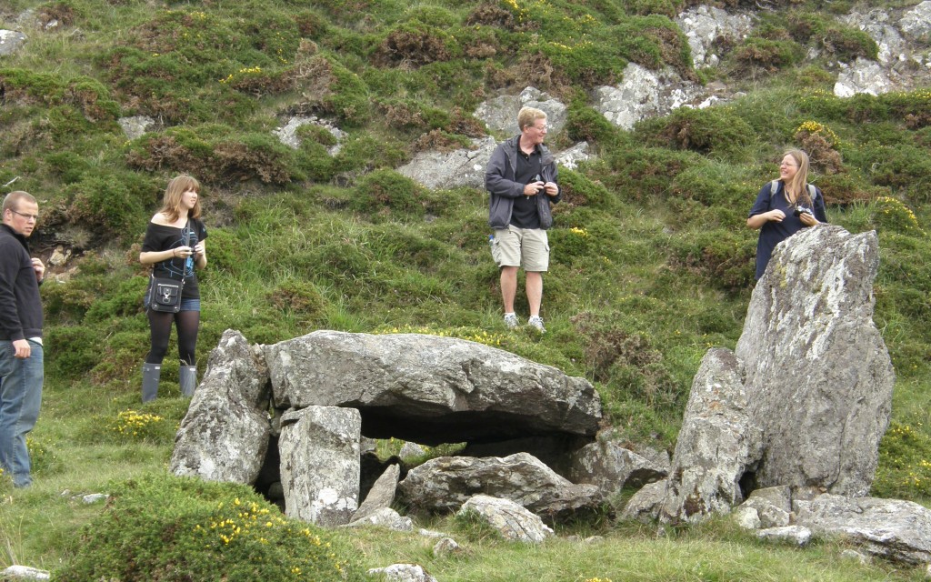
Our bus next took us about twenty minutes south of Roundstone to Cashel Hill (Cnoc an Cháisil) where we climbed about eight hundred yards up the hill from a roadside cottage to a megalithic tomb dating from the end of the Stone Age or beginning of the Bronze Age, about 4500 years ago. It is known locally as Altoir Ula (altoir means “altar” and ula refers a tomb or penitential station ); it is also said to have been a “Mass Rock”, a place used by outlaw Roman Catholic priests to celebrate Holy Communion when Roman Catholicism was illegal during what are called “the Penal times”.
Looking like a low hut built out of a few massive and irregular stone slabs, it is a wedge-shaped gallery grave. Its chamber narrows towards the rear or eastern end. The cap-stone forming its roof is about five feet square and sixteen inches thick, and rests on smaller slabs set edgeways in the ground to form the sides, which are the interior stones of double-sided walls. One of these outer slabs, five feet high, stands forward of the main chamber as a sort of portico at the front of the tomb. Originally the whole construction would have been covered by a cairn, traces of which can be seen around it. This is the only known megalithic tomb in the South Connemara area.
After the tomb, Michael showed us a nearby active bog and explained how bogs grow. He showed us how to walk through bog safely (don’t ever try to jump from place to place!) and demonstrated the buoyancy of a bog mat. One of our classmates, Mara B., stepped out onto the mat (at Michael’s invitation). It was fascinating the way the “ground” in the bog bounced as others walked across it. The mat on which Michael and then Mara stood moved dramatically! The bog water around the mat may have been as many as 18 feet deep; Michael probed with his 5-foot walking stick and met no resistance. The bog is much like quicksand and can suck a person under in just a few minutes.


Quite interesting information about the bogs. Are they the same as Peat Bogs that you have blogged about earlier?
Blessings
Kim – yes, this is how they start … eventually the watery bog fills in with compacted decaying/decayed bog plants to form the turf which is dug out in “sods”, dried, and burned. There is a pretty good quick explanation of bog formation at this website: http://www.wesleyjohnston.com/users/ireland/geography/bogs.html